
Telaga Tujuh地形图
点击地图以显示海拔。
关于这张地图
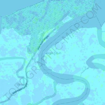
名称:Telaga Tujuh地形图、海拔、地势。
地点:Telaga Tujuh, Aceh, Indonesia (4.49717 98.00049 4.53717 98.04049)
平均海拔:1 米
最低海拔:-4 米
最高海拔:5 米
其他地形图
点击地图以查看其地形、其海拔和其地势。
Banda Aceh
Banda Aceh (/bʌndəˈɑːtʃeɪ/ BUN-duh-AH-cheh; Acehnese: Banda Acèh, Jawoë: بند اچيه) is the capital and largest city in the province of Aceh, Indonesia. It is located on the island of Sumatra and has an elevation of 35 metres (115 ft). The city covers an area of 61.36 square kilometers (23.69 sq…
平均海拔:5 米
Aceh Tengah
Central Aceh District is a highland area with an altitude between 200 – 2600 metres above sea level and with an area of 4,527.53 km2.
平均海拔:936 米
Lhokseumawe
Lhokseumawe City is located between 4˚ - 5˚ North Latitude and 96˚ - 97˚ East Longitude with an average altitude of 13 metres above sea level. Lhokseumawe was given the status of an independent city (separate from North Aceh Regency, which surrounds it on all the landward sides) based on Law Number 2 of…
平均海拔:10 米
Aceh Tengah
Central Aceh District is a highland area with an altitude between 200 – 2600 metres above sea level and with an area of 4,527.58 km2.
平均海拔:936 米
Banda Aceh
Banda Aceh is the capital and largest city in the province of Aceh, Indonesia. It is located on the island of Sumatra and has an elevation of 35 meters. The city covers an area of 61.4 square kilometres and had a population of 223,446 people at the 2010 Census, rising to 250,227 at the 2015 Census; the latest…
平均海拔:5 米
Banda Aceh
Banda Aceh, formerly Kutaraja (Koetaradja, 1948–1962), is the capital and largest city in the province of Aceh, Indonesia. It is located on the island of Sumatra and has an elevation of 35 meters. The city covers an area of 61.4 square kilometres and had a population of 223,446 people at the 2010 Census,…
平均海拔:5 米