
Simeulue地形图
点击地图以显示海拔。
Simeulue
Much of the north-western half of the island has been recognised as an Important Bird Area (IBA) by BirdLife International. It contains forested hills up to an elevation of 576 m, as well as two freshwater lakes. The Simeulue scops-owl is endemic.
关于这张地图
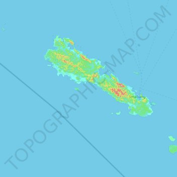
名称:Simeulue地形图、海拔、地势。
地点:Simeulue, Aceh, Sumatra, 23891, Indonesia (2.05778 95.38492 3.01790 96.68869)
平均海拔:6 米
最低海拔:-2 米
最高海拔:561 米
其他地形图
点击地图以查看其地形、其海拔和其地势。