Dunes City地形图
点击地图以显示海拔。
关于这张地图
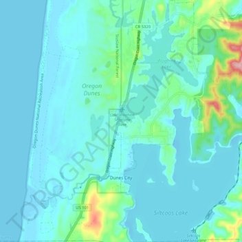
名称:Dunes City地形图、海拔、地势。
地点:Dunes City, Lane County, Oregon, United States (43.86328 -124.12476 43.93777 -124.07849)
平均海拔:23 米
最低海拔:-3 米
最高海拔:178 米
其他地形图
点击地图以查看其地形、其海拔和其地势。

点击地图以显示海拔。
名称:Dunes City地形图、海拔、地势。
地点:Dunes City, Lane County, Oregon, United States (43.86328 -124.12476 43.93777 -124.07849)
平均海拔:23 米
最低海拔:-3 米
最高海拔:178 米
点击地图以查看其地形、其海拔和其地势。