
Thermal地形图
点击地图以显示海拔。
关于这张地图
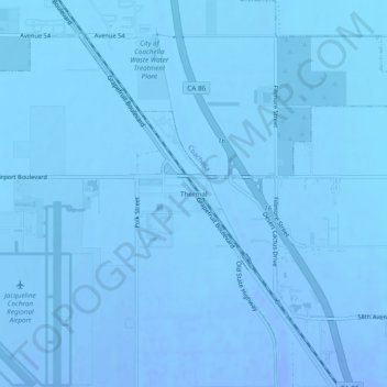
名称:Thermal地形图、海拔、地势。
地点:Thermal, Riverside County, California, United States (33.62030 -116.15945 33.66030 -116.11945)
平均海拔:-36 米
最低海拔:-45 米
最高海拔:-14 米
其他地形图
点击地图以查看其地形、其海拔和其地势。
Indio
United States > California > Riverside County
Indio is home of Riverside County's eastern administration offices. Palm Springs had more people from 1955 to 1992, when the US census announced that Indio surpassed Palm Springs and that title was returned to them. The official elevation of Indio is below sea level; the city hall is 14 feet (4 m) below sea…
平均海拔:74 米
Santa Rosa and San Jacinto Mountains National Monument
United States > California > Riverside County
The differences in elevation, temperature, and moisture give rise to diverse vegetation. Being the western boundary of the Sonoran Desert, the eastern mountainslopes are hotter and drier, while the western side is affected by the Pacific Ocean and receives more precipitation with cooler temperatures. There are…
平均海拔:900 米
Palm Springs
United States > California > Riverside County
One possible origin of palm in the place name comes from early Spanish explorers who referred to the area as La Palma de la Mano de Dios or "The Palm of God's hand". The earliest use of the name "Palm Springs" is from United States Topographical Engineers who used the term in 1853 maps. According to William…
平均海拔:859 米
Colorado River
United States > California > Riverside County
The entire eastern boundary of the Colorado River Basin runs along the North American Continental Divide and is defined largely by the Rocky Mountains and the Rio Grande Basin. The Wind River Range in Wyoming marks the northern extent of the basin, and is separated from the Colorado Rockies by the endorheic…
平均海拔:93 米
Desert Hot Springs
United States > California > Riverside County
Summer winds and the higher elevation keep Desert Hot Springs on average 5-7 degrees cooler than other communities in Coachella Valley. However, the winter season can be warmer due to the surrounding mountains blocking north winds. Since it lies at a higher elevation than the cities further south, cold air…
平均海拔:498 米
Coachella
United States > California > Riverside County
The elevation is 68 feet (21 m) below sea level, as the eastern half of the Coachella Valley is below sea level. The saltwater lake, Salton Sea, 10 miles (16 km) south of Coachella, is 228 feet (69 m) below sea level.
平均海拔:-2 米
La Quinta
United States > California > Riverside County
According to the United States Census Bureau, the city has a total area of 35.6 square miles (92 km2), of which 35.1 square miles (91 km2) is land and 0.4 square miles (1.0 km2) (1.22%) is water. The city's elevation is 56 feet (20 m) above sea level.
平均海拔:201 米
Idyllwild-Pine Cove
United States > California > Riverside County
"Mile-high Idyllwild" is a mountain resort about one-mile (1,600 m) in altitude. Idyllwild is flanked by two large rock formations, Tahquitz Peak and Suicide Rock (also known as Lily Rock), which are famous in Southern California rock-climbing circles. It offers no skiing, so "the Hill" has been minimally…
平均海拔:1,746 米