
Sahale Mountain地形图
点击地图以显示海拔。
Sahale Mountain
The North Cascades features some of the most rugged topography in the Cascade Range with craggy peaks and ridges, deep glacial valleys, and granite spires. Geological events occurring many years ago created the diverse topography and drastic elevation changes over the Cascade Range leading to various climate differences.
关于这张地图
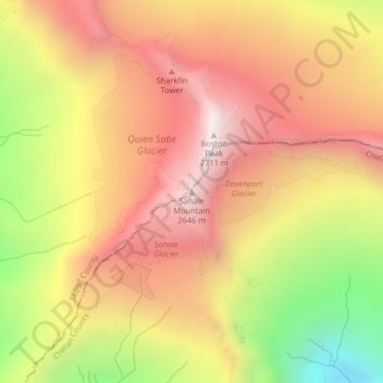
名称:Sahale Mountain地形图、海拔、地势。
地点:Sahale Mountain, Skagit County, Washington, United States (48.49136 -121.03844 48.49146 -121.03834)
平均海拔:2,132 米
最低海拔:1,357 米
最高海拔:2,677 米
其他地形图
点击地图以查看其地形、其海拔和其地势。
Concrete
United States > Washington > Skagit County
Mears Field (3W5), formerly known as Concrete Municipal Airport, is located one mile south of Concrete at an elevation of 267 ft MSL.
平均海拔:125 米