
Camiling地形图
点击地图以显示海拔。
Camiling
Mostly of plain topography but some parts are hilly to mountainous in which the barangays of Papaac, Bacsay, Birbira and Cayasan, to name a few. The deeper part of the mountains can be described as a place where wild animals live, such as deer, Toddy cat (Musang), wild boar (Baboy ramo), Monitor lizard (Bayawak).
关于这张地图
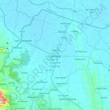
名称:Camiling地形图、海拔、地势。
地点:Camiling, Tarlac, Central Luzon, 2306, Philippines (15.61799 120.30535 15.75875 120.49339)
平均海拔:32 米
最低海拔:8 米
最高海拔:450 米
其他地形图
点击地图以查看其地形、其海拔和其地势。