
Warwick地形图
点击地图以显示海拔。
Warwick
Warwick has a humid subtropical climate (Köppen Cfa) with hot summers and cool to cold winters. It is slightly cooler and less humid than the proximate southeast Queensland coast due to its inland, elevation location. Frost is present in winter. The climate bears similarities with Richmond, an inland suburb of Sydney, in central New South Wales.
关于这张地图
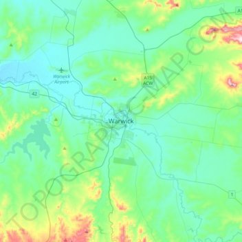
名称:Warwick地形图、海拔、地势。
平均海拔:517 米
最低海拔:430 米
最高海拔:903 米
其他地形图
点击地图以查看其地形、其海拔和其地势。