
Seven Springs地形图
点击地图以显示海拔。
关于这张地图
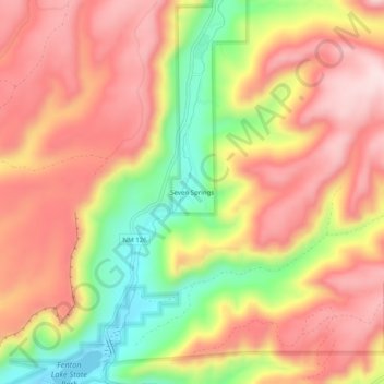
名称:Seven Springs地形图、海拔、地势。
地点:Seven Springs, Sandoval County, New Mexico, United States (35.88190 -106.73174 35.92190 -106.69174)
平均海拔:2,538 米
最低海拔:2,337 米
最高海拔:2,678 米
其他地形图
点击地图以查看其地形、其海拔和其地势。
Rio Rancho
United States > New Mexico > Sandoval County
Rio Rancho is in an arid climate due to its location in the rain shadow of the Sandia Mountains to the east and the Continental Divide to the west. Rio Rancho receives 8.90 inches of precipitation annually on average. The western portion of the city receives slightly more rain and snowfall due to its higher…
平均海拔:1,672 米