
Hilltop地形图
点击地图以显示海拔。
关于这张地图
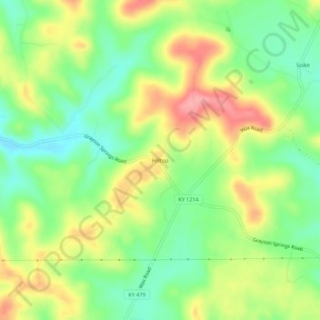
名称:Hilltop地形图、海拔、地势。
地点:Hilltop, Grayson County, Kentucky, United States (37.37505 -86.12719 37.41505 -86.08719)
平均海拔:215 米
最低海拔:170 米
最高海拔:273 米
其他地形图
点击地图以查看其地形、其海拔和其地势。
Rough River Lake
United States > Kentucky > Grayson County
As the seasons change, so does the size of the Rough River Lake. During the summer the lake is about 5,100 acres (2,100 ha), has 220 miles (350 km) of shoreline, is 39 miles long, and is 65 feet (20 m) deep in the deepest portion of the lake, which includes the area around the dam. During the winter the lake…
平均海拔:183 米