
Pico de Orizaba地形图
点击地图以显示海拔。
Pico de Orizaba
Citlaltépetl (from Náhuatl citlal(in) = star, and tepētl = mountain), otherwise known as Pico de Orizaba, is an active volcano and the highest in North America, as well as the highest mountain in Mexico and third highest peak in North America, after Denali/Mount McKinley of the United States and Mount Logan of Canada. It rises 5,636 metres (18,491 ft) above sea level in the eastern end of the Trans-Mexican Volcanic Belt, on the border between the states of Veracruz and Puebla. The volcano is currently dormant but not extinct, with the last eruption taking place during the 19th century. It is the second most prominent volcanic peak in the world after Mount Kilimanjaro. Pico de Orizaba is ranked 16th by topographic isolation.
关于这张地图
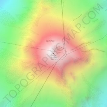
名称:Pico de Orizaba地形图、海拔、地势。
地点:Pico de Orizaba, Chalchicomula de Sesma, Puebla, Mexico (19.03028 -97.26987 19.03038 -97.26977)
平均海拔:4,969 米
最低海拔:4,327 米
最高海拔:5,589 米