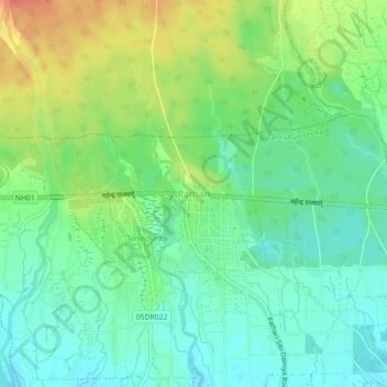
地理定位

Pathari地形图

点击地图以显示海拔

关于这张地图

名称Pathari地形图、海拔、地势。

地点Pathari, Patahrishanishchare, Morang, Koshi Province, 56600, Nepal (26.64101 87.53909 26.68101 87.57909)

平均海拔:139 米

最低海拔:120 米

最高海拔:171 米

其他地形图

点击地图以查看其地形、其海拔和其地势

Betana Wetlands

Nepal > Koshi Province > Morang

平均海拔:136 米

Letang

Nepal > Koshi Province > Morang

平均海拔:616 米

Ratuwamai-10

Nepal > Koshi Province > Morang

平均海拔:94 米

Biratnagar

Nepal > Koshi Province > Morang

平均海拔:70 米

Sundarharaicha

Nepal > Koshi Province > Morang

平均海拔:126 米

Patahrishanishchare

Nepal > Koshi Province > Morang

平均海拔:110 米