
Barhan地形图
点击地图以显示海拔。
关于这张地图
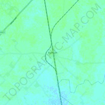
名称:Barhan地形图、海拔、地势。
地点:Barhan, Etmadpur, Agra District, Uttar Pradesh, 283201, India (27.29239 78.15067 27.37239 78.23067)
平均海拔:171 米
最低海拔:168 米
最高海拔:175 米
其他地形图
点击地图以查看其地形、其海拔和其地势。
Jewar
Jewar is located at 28°07′N 77°20′E / 28.12°N 77.33°E / 28.12; 77.33. It has an average elevation of 195 metres (640 ft). It is located between 28.13° north latitude and 77.55° east longitude at an elevation of 195 metres (640 ft). It is on the northeast bank of the Yamuna River.
平均海拔:195 米
Bahraich
Topography: The district's terrain is characterized by a mix of plain and hilly areas. The northern part of the district, bordering Nepal, is mountainous and forms a part of the foothills of the Himalayas. The southern part is predominantly plain, formed by the Gangetic alluvial plains.
平均海拔:194 米
Kannauj
Kannauj is located at 27°04′N 79°55′E / 27.07°N 79.92°E / 27.07; 79.92. It has an average elevation of 139 metres (456 feet).
平均海拔:141 米
Mathura
Mathura is located at 27°17′N 77°25′E / 27.28°N 77.41°E / 27.28; 77.41. It has an average elevation of 174 metres (570 feet). The climate of Mathura is tropical extreme with very hot summers with temperatures rising beyond 44 °C, and cold and foggy winters with the temperature dipping to 5…
平均海拔:183 米
Sitapur
Sitapur is located at 27.57°N 80.68°E. It test has an average elevation of 138 meters (452 feet). It is located in the Gangetic Plain, with elevations ranging from 150 m above sea level in the north-west to 100 m in the south-east. It is intersected by numerous streams and ravines and contains many shallow…
平均海拔:131 米