
St Michaels地形图
点击地图以显示海拔。
关于这张地图
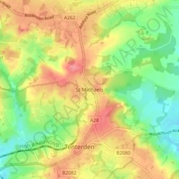
名称:St Michaels地形图、海拔、地势。
地点:St Michaels, Ashford, Kent, England, TN30 6BY, United Kingdom (51.06287 0.67240 51.10287 0.71240)
平均海拔:41 米
最低海拔:4 米
最高海拔:76 米
其他地形图
点击地图以查看其地形、其海拔和其地势。
Ham Street Woods National Nature Reserve
United Kingdom > England > Kent > Ashford > Hamstreet
平均海拔:31 米