
Mount Magazine State Park地形图
点击地图以显示海拔。
Mount Magazine State Park
There also exist many opportunities for ATV riding, backpacking, hang gliding, mountain biking, rappelling, and rock climbing within the park. The park hosts the annual Mount Magazine International Butterfly Festival, and is a haven for many rare species of butterflies in Arkansas due to the special blend of altitude and temperature available. The state butterfly, the Diana fritillary, is found almost exclusively in the Arkansas River Valley and the Petit Jean River Valley.
关于这张地图
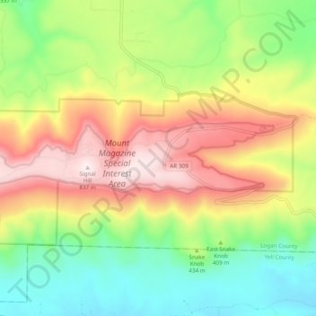
名称:Mount Magazine State Park地形图、海拔、地势。
平均海拔:447 米
最低海拔:149 米
最高海拔:839 米
其他地形图
点击地图以查看其地形、其海拔和其地势。
Magazine Mountain
United States > Arkansas > Logan County
Mount Magazine is often called "the highest point between the Alleghenies and the Rockies" (there are mountains located in the Trans-Pecos region of far-west Texas which exceed Mount Magazine in elevation and prominence, although the Trans-Pecos region lies so far south of the Rockies, that region arguably…
平均海拔:670 米