Plage地形图
点击地图以显示海拔。
关于这张地图
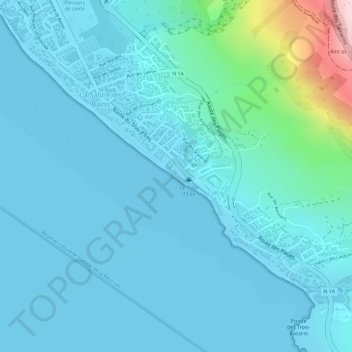
名称:Plage地形图、海拔、地势。
平均海拔:41 米
最低海拔:0 米
最高海拔:319 米
其他地形图
点击地图以查看其地形、其海拔和其地势。
Ravine Saint-Gilles
France > La Réunion > Saint-Paul > Saint-Gilles-les-Hauts > Village de l'Éperon
平均海拔:310 米

点击地图以显示海拔。
名称:Plage地形图、海拔、地势。
平均海拔:41 米
最低海拔:0 米
最高海拔:319 米
点击地图以查看其地形、其海拔和其地势。
France > La Réunion > Saint-Paul > Saint-Gilles-les-Hauts > Village de l'Éperon
平均海拔:310 米