
Harricott地形图
点击地图以显示海拔。
关于这张地图
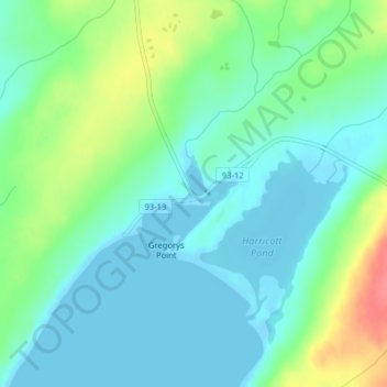
名称:Harricott地形图、海拔、地势。
地点:Harricott, Newfoundland, Newfoundland and Labrador, Canada (47.16437 -53.54594 47.18437 -53.52594)
平均海拔:19 米
最低海拔:-7 米
最高海拔:69 米
其他地形图
点击地图以查看其地形、其海拔和其地势。
Clarenville
Canada > Newfoundland and Labrador
The Clarenville area has many of the physical features characteristic of the East Coast of Newfoundland and has a marine climate. It lies along the coastal slopes which rise from the Atlantic Ocean towards the interior central plateau of the island. The dominating physical feature is a ridge of broken peaks…
平均海拔:102 米