点击地图以显示海拔。
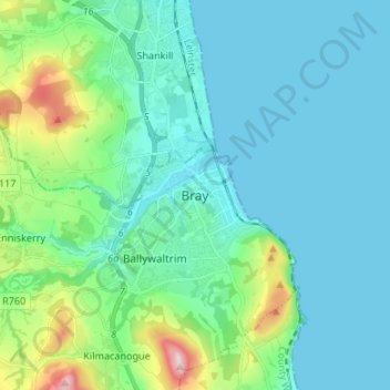
名称:Bray地形图、海拔、地势。
地点:Bray, The Municipal District of Bray, County Wicklow, Leinster, A98 V827, Ireland (53.16146 -6.15050 53.24146 -6.07050)
平均海拔:58 米
最低海拔:0 米
最高海拔:331 米