
Tanahi地形图
点击地图以显示海拔。
关于这张地图
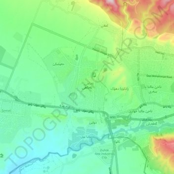
名称:Tanahi地形图、海拔、地势。
平均海拔:518 米
最低海拔:379 米
最高海拔:884 米
其他地形图
点击地图以查看其地形、其海拔和其地势。
Halabja Governorate
Halabja is located in the Shahrizor plain, a fertile valley nestled in the foothills of the Zagros Mountains in the Kurdistan Region of Iraq. The city's elevation is around 700 meters above sea level. The surrounding area is characterized by mountainous terrain, with the Hawraman Mountain range to the east,…
平均海拔:1,055 米
Darbandikhan Dam
The dam is located within a gorge on a foundation of sedimentary rocks. It is a rock-fill embankment type with a central clay core. The dam is 128 m (420 ft) tall and 445 m (1,460 ft) long (535 m (1,755 ft) if the spillway section is included). Its crest is 17 m (56 ft) wide and at an elevation of 495 m (1,624…
平均海拔:571 米
Al-Anbar Governorate
Anbar is one of the driest governorates in Iraq's western desert climate. Some of Al Anbar is part of the Syrian Desert, characterized by steppe and desert terrain. Most of Al Anbar is considered as a topographical continuation of the Arabian Peninsula plateau region. It has some small hills and a number of…
平均海拔:399 米