
Sarangkot地形图
点击地图以显示海拔。
Sarangkot
The Ward is located on Sarangkot, a hill on the western side of Pokhara with an altitude of 1600m. Sarangkot is known for its panoramic Himalayan views of Dhaulagiri, Annapurna and Manaslu. It also provides an expansive view of the city of Pokhara, from the extreme north to the south including Phewa Lake. Tourists drive up the hill to watch the sunrise from the view tower at the top. In recent years, Sarangkot has been called one of the best paragliding locations in the world. The hike up from the Pokhara Baglung highway at Miruwa to Sarangkot takes 90 minutes to 1.5hours.
关于这张地图
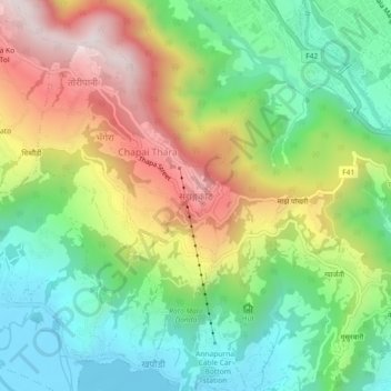
名称:Sarangkot地形图、海拔、地势。
地点:Sarangkot, Pokhara, Kaski, Gandaki Province, 33700, Nepal (28.22452 83.92765 28.26452 83.96765)
平均海拔:1,139 米
最低海拔:795 米
最高海拔:1,657 米
其他地形图
点击地图以查看其地形、其海拔和其地势。