
Tekoa Mountain地形图
点击地图以显示海拔。
Tekoa Mountain
Tekoa Mountain overlooks the Westfield River Gorge and the Connecticut River Valley. The town of Russell and its villages, Woronoco and Crescent Mills, lie at the foot of the mountain along the Westfield River. From the summit ledges, the cities of Westfield and Springfield, Massachusetts are visible to the east. The southwest and northeast sides of Tekoa Mountain are steep and rugged with frequent cliff faces and rocky overlooks; to the north, the topography gradually flattens out as Tekoa Mountain merges with the upland plateau of Montgomery. The southwest side of Tekoa Mountain drains into the Westfield River, thence into the Connecticut River and Long Island Sound; the northeast side drains into Moose Meadow Brook, thence the Westfield River.
关于这张地图
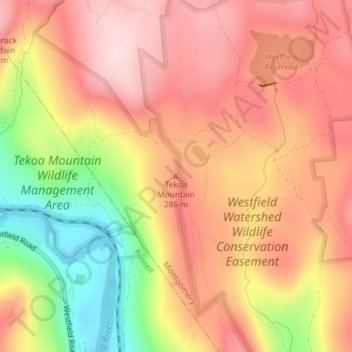
名称:Tekoa Mountain地形图、海拔、地势。
平均海拔:241 米
最低海拔:65 米
最高海拔:351 米