
Viramgam地形图
点击地图以显示海拔。
Viramgam
Viramgam is located at 23°07′N 72°02′E / 23.12°N 72.03°E / 23.12; 72.03. It has an average elevation of 32 metres (105 ft). The old town of Viramgam is surrounded by a rectangular, tower flanked brick and stone wall, about 21 miles round.
关于这张地图
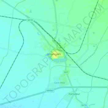
名称:Viramgam地形图、海拔、地势。
地点:Viramgam, Viramgam Taluka, Ahmedabad, Gujarat, 382150, India (23.08245 72.00839 23.16245 72.08839)
平均海拔:28 米
最低海拔:24 米
最高海拔:39 米