点击地图以显示海拔。
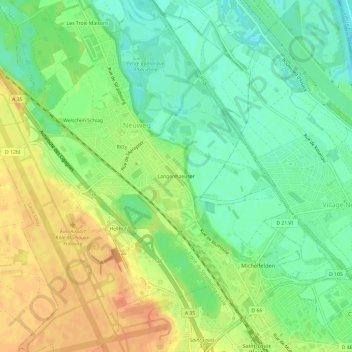
名称:Langenhaeuser地形图、海拔、地势。
地点:Langenhaeuser, Saint-Louis, Mulhouse, Haut-Rhin, Grand Est, France métropolitaine, 68300, France (47.58871 7.52175 47.62871 7.56175)
平均海拔:252 米
最低海拔:233 米
最高海拔:273 米
点击地图以查看其地形、其海拔和其地势。
France > Grand Est > Haut-Rhin > Saint-Louis > Hellhof
平均海拔:263 米
France > Grand Est > Haut-Rhin > Saint-Louis
平均海拔:269 米