
Satyamangalam地形图
点击地图以显示海拔。
Satyamangalam
Sathyamangalam is situated in the region between the Eastern and Western Ghats, which are separated by the Moyar River valley in Nilgiris towards the north. The general topography is not flat and covered by sloping lands. Bhavani river flows at the center of the town from west to east. Agricultural wet lands are predominant on both sides of the river and dry lands are predominant on the northern side of the town. The soil mainly consists of black loam, red loam and red sand.
关于这张地图
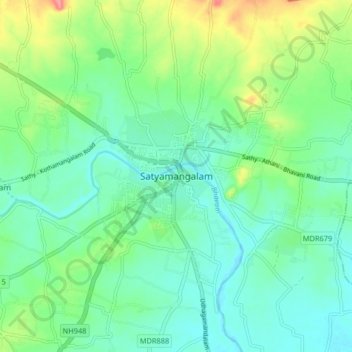
名称:Satyamangalam地形图、海拔、地势。
平均海拔:248 米
最低海拔:224 米
最高海拔:310 米
其他地形图
点击地图以查看其地形、其海拔和其地势。