Galesville地形图
点击地图以显示海拔。
关于这张地图
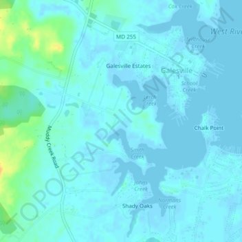
名称:Galesville地形图、海拔、地势。
地点:Galesville, Anne Arundel County, Maryland, United States (38.82233 -76.56362 38.85161 -76.53527)
平均海拔:4 米
最低海拔:-3 米
最高海拔:29 米

点击地图以显示海拔。
名称:Galesville地形图、海拔、地势。
地点:Galesville, Anne Arundel County, Maryland, United States (38.82233 -76.56362 38.85161 -76.53527)
平均海拔:4 米
最低海拔:-3 米
最高海拔:29 米