
Ryker地形图
点击地图以显示海拔。
关于这张地图
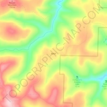
名称:Ryker地形图、海拔、地势。
地点:Ryker, Newton County, Arkansas, United States (35.86813 -93.49352 35.90813 -93.45352)
平均海拔:641 米
最低海拔:503 米
最高海拔:756 米
其他地形图
点击地图以查看其地形、其海拔和其地势。
Buffalo National River
United States > Arkansas > Newton County
Along the upper river, the gradient is steep and the water is fast, leveling and slowing as the river runs its course. The upper section has most of the whitewater rapids to be found along the river, and features dramatic karst topography including sink holes and caves, springs, and waterfalls, over 500-foot…
平均海拔:444 米