
Manotick地形图
点击地图以显示海拔。
关于这张地图
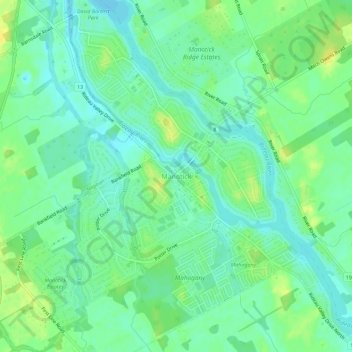
名称:Manotick地形图、海拔、地势。
地点:Manotick, Ottawa, Eastern Ontario, Ontario, K4M 0G8, Canada (45.20644 -75.70606 45.24644 -75.66606)
平均海拔:91 米
最低海拔:82 米
最高海拔:104 米
其他地形图
点击地图以查看其地形、其海拔和其地势。
Rideau Canal
Most of the locks are still hand-operated. There are a total of 45 locks at 23 stations along the canal, plus two locks (locks 33 and 34) at the entrance to the Tay Canal (leading to Perth). The elevation between the Ottawa River and its summit at Upper Rideau Lake, is 83 metres (273 feet), the elevation…
平均海拔:69 米