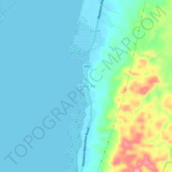
点击地图以显示海拔。
名称:Sante Fe地形图、海拔、地势。
地点:Sante Fe, Matalom, 5th District, Leyte, Eastern Visayas, 6526, Philippines (10.21317 124.75158 10.25317 124.79158)
平均海拔:26 米
最低海拔:0 米
最高海拔:129 米
点击地图以查看其地形、其海拔和其地势。
Philippines > Leyte > Matalom
平均海拔:0 米