点击地图以显示海拔。
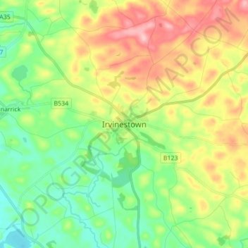
名称:Irvinestown地形图、海拔、地势。
地点:Irvinestown, County Fermanagh, Northern Ireland, BT94 1GJ, United Kingdom (54.43201 -7.67348 54.51201 -7.59348)
平均海拔:95 米
最低海拔:41 米
最高海拔:179 米
点击地图以查看其地形、其海拔和其地势。
United Kingdom > Northern Ireland > County Fermanagh
平均海拔:60 米
平均海拔:232 米
平均海拔:48 米