
Blue Ridge Summit地形图
点击地图以显示海拔。
Blue Ridge Summit
Pennsylvania Route 16 passes through Blue Ridge Summit, leading east down the mountain to Emmitsburg, Maryland, and west downhill to Waynesboro. The highway elevation at Blue Ridge Summit is 1,330 feet (410 m), compared to elevations of 500 and 700 feet (150 and 210 m) east and west of the mountain, respectively. Mount Dunlop, overlooking Blue Ridge Summit to the west, rises to a summit of 1,700 feet (520 m). Monterey Pass is northwest and slightly downhill from the community along PA 16.
关于这张地图
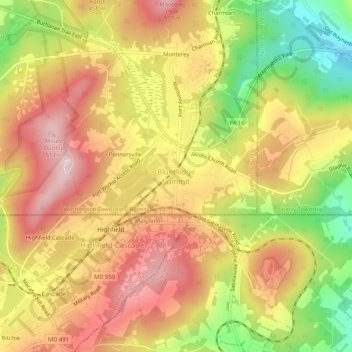
名称:Blue Ridge Summit地形图、海拔、地势。
平均海拔:400 米
最低海拔:244 米
最高海拔:516 米