点击地图以显示海拔。
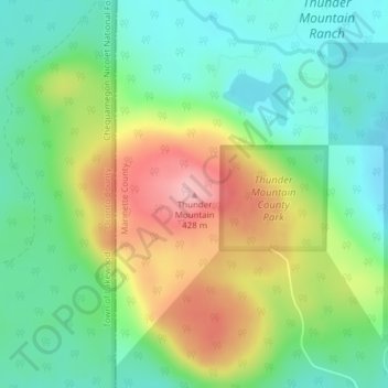
名称:Thunder Mountain地形图、海拔、地势。
地点:Thunder Mountain, Town of Stephenson, Marinette County, Wisconsin, United States (45.30603 -88.30016 45.30613 -88.30006)
平均海拔:336 米
最低海拔:281 米
最高海拔:428 米
点击地图以查看其地形、其海拔和其地势。
United States > Wisconsin > Marinette County
平均海拔:311 米
平均海拔:301 米
平均海拔:295 米
平均海拔:373 米
平均海拔:186 米
平均海拔:309 米
平均海拔:250 米
平均海拔:267 米
平均海拔:305 米