
Fire Island地形图
点击地图以显示海拔。
关于这张地图
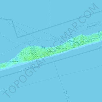
名称:Fire Island地形图、海拔、地势。
平均海拔:0 米
最低海拔:-1 米
最高海拔:7 米
其他地形图
点击地图以查看其地形、其海拔和其地势。
Middle Island
United States > New York > Suffolk County > Town of Brookhaven
On October 27, 1910, the International Aviation Tournament was held at the Belmont Park racetrack in Elmont, New York. The meet offered $3,750 for the highest altitude, another $1,000 for a world record and a $5,000 bonus for exceeding 10,000 feet. Ralph Johnstone set a new American flight altitude record of…
平均海拔:31 米