Bucktown地形图
点击地图以显示海拔。
关于这张地图
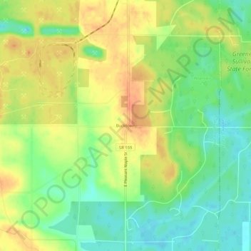
名称:Bucktown地形图、海拔、地势。
地点:Bucktown, Sullivan County, Indiana, United States (38.97477 -87.28001 39.01477 -87.24001)
平均海拔:167 米
最低海拔:145 米
最高海拔:188 米
其他地形图
点击地图以查看其地形、其海拔和其地势。

点击地图以显示海拔。
名称:Bucktown地形图、海拔、地势。
地点:Bucktown, Sullivan County, Indiana, United States (38.97477 -87.28001 39.01477 -87.24001)
平均海拔:167 米
最低海拔:145 米
最高海拔:188 米
点击地图以查看其地形、其海拔和其地势。