
Waters地形图
点击地图以显示海拔。
关于这张地图
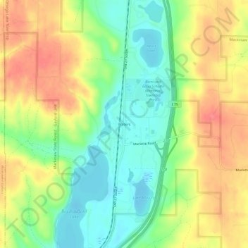
名称:Waters地形图、海拔、地势。
平均海拔:414 米
最低海拔:378 米
最高海拔:454 米
其他地形图
点击地图以查看其地形、其海拔和其地势。
Gaylord
United States > Michigan > Otsego County
Gaylord sees significant snowfall during winter due to its elevation and its location in the path of lake-effect snow produced by Lake Michigan. Combined with local terrain and topography, many winter recreation opportunities abound.
平均海拔:401 米
Gaylord
United States > Michigan > Otsego County
Gaylord became a city in 1922. The change from village to city required a vote by town residents. For reasons that are unclear, the margin of passage was a very close 21 votes — 114 people in favor to 93 against. John Hamilton was elected the first mayor of Gaylord. Over the years, the community continued to…
平均海拔:401 米
Gaylord
United States > Michigan > Otsego County
Gaylord sees significant snowfall during winter due to its elevation and its location in the path of lake-effect snow produced by Lake Michigan. Combined with local terrain and topography, many winter recreation opportunities abound.
平均海拔:401 米