
Bulu Hatu地形图
点击地图以显示海拔。
关于这张地图
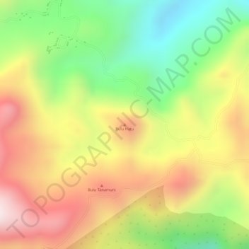
名称:Bulu Hatu地形图、海拔、地势。
地点:Bulu Hatu, South Sulawesi, Sulawesi, Indonesia (-5.05515 120.06495 -5.05505 120.06505)
平均海拔:644 米
最低海拔:349 米
最高海拔:917 米
其他地形图
点击地图以查看其地形、其海拔和其地势。
Makassar
Makassar City is a city located near the coast that stretches along the western and northern corridors and is also known as the "Waterfront City" which contains several rivers such as the Tallo River, Jeneberang River, and Pampang River) all of which flow into the city. Makassar City is a stretch of lowland at…
平均海拔:13 米