Brownsboro地形图
点击地图以显示海拔。
关于这张地图
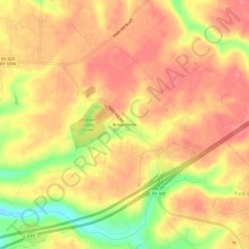
名称:Brownsboro地形图、海拔、地势。
地点:Brownsboro, Oldham County, Kentucky, United States (38.33618 -85.51829 38.37618 -85.47829)
平均海拔:226 米
最低海拔:174 米
最高海拔:250 米
其他地形图
点击地图以查看其地形、其海拔和其地势。

点击地图以显示海拔。
名称:Brownsboro地形图、海拔、地势。
地点:Brownsboro, Oldham County, Kentucky, United States (38.33618 -85.51829 38.37618 -85.47829)
平均海拔:226 米
最低海拔:174 米
最高海拔:250 米
点击地图以查看其地形、其海拔和其地势。