
Western地形图
点击地图以显示海拔。
关于这张地图
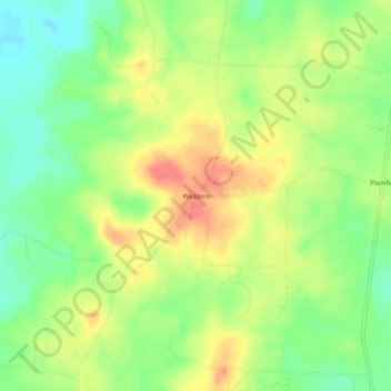
名称:Western地形图、海拔、地势。
地点:Western, Columbia County, Arkansas, United States (33.02652 -93.36184 33.06652 -93.32184)
平均海拔:82 米
最低海拔:52 米
最高海拔:115 米
其他地形图
点击地图以查看其地形、其海拔和其地势。
Magnolia
United States > Arkansas > Columbia County
Magnolia is located in southwest Arkansas, north of the center of Columbia County. The average altitude is 336 ft (102 m) above sea level according to NOAA. The surrounding region is a mix of dense forest, farm prairies, and low rolling hills.
平均海拔:91 米