
Pal地形图
点击地图以显示海拔。
Pal
Pal village is located at 21°21′43″N 75°54′11″E / 21.361853°N 75.902929°E / 21.361853; 75.902929. It has average elevation of 397 meters from the sea level. Due to its high elevation and isolated nature in Satpura mountains surrounded by forests, Pal is locally known as picnic spot and hill station. Forest surrounding Pal village falls under protected area of Yawal Wildlife Sanctuary, but the village itself falls under the jurisdictional area of the Raver tehsil.
关于这张地图
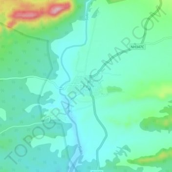
名称:Pal地形图、海拔、地势。
地点:Pal, Raver, Jalgaon, Maharashtra, India (21.34139 75.88252 21.38139 75.92252)
平均海拔:417 米
最低海拔:371 米
最高海拔:579 米