
Ongole地形图
点击地图以显示海拔。
Ongole
Ongole is located at 15.5°N 80.05°E. It has an average elevation of 10 m (33 ft) AMSL and is situated on the plains. The city is around 149 kilometres (93 mi) to the south west of Amaravati, the stat capital.
关于这张地图
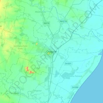
名称:Ongole地形图、海拔、地势。
地点:Ongole, Prakasam, Andhra Pradesh, 523002, India (15.34587 79.88995 15.66587 80.20995)
平均海拔:15 米
最低海拔:0 米
最高海拔:137 米