
Indrasan地形图
点击地图以显示海拔。
Indrasan
Mount Indrasan is located at an altitude of 6221 metres above sea level in Kullu district, Himachal Pradesh. Mt. Indrasan is considered as the most difficult mountain to climb in the Pir Panjal range of the Himalayas because of the challenges involved in scaling it. It was first climbed on October 13, 1962, by an expedition organized by Kyoto University Alpine Club, Kyoto, Japan.
关于这张地图
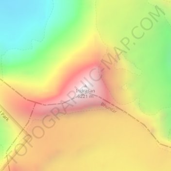
名称:Indrasan地形图、海拔、地势。
地点:Indrasan, Lahul, Lahaul and Spiti, Himachal Pradesh, India (32.21374 77.39639 32.21384 77.39649)
平均海拔:5,374 米
最低海拔:4,527 米
最高海拔:6,189 米
其他地形图
点击地图以查看其地形、其海拔和其地势。