
Latnivaara地形图
点击地图以显示海拔。
关于这张地图
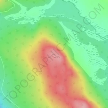
名称:Latnivaara地形图、海拔、地势。
地点:Latnivaara, Kiruna kommun, Norrbotten County, Sweden (67.99086 20.74341 67.99096 20.74351)
平均海拔:389 米
最低海拔:340 米
最高海拔:463 米
其他地形图
点击地图以查看其地形、其海拔和其地势。
Abisko National Park
Permafrost is common in the national park, though permafrost at lower elevations is disappearing because of global warming and increased snowfall.
平均海拔:740 米
Torneträsk
Permafrost is common in the land around the lake. This low elevation permafrost is disappearing because of global warming and increased snowfall.
平均海拔:768 米