点击地图以显示海拔。
名称:Enchiroulet地形图、海拔、地势。
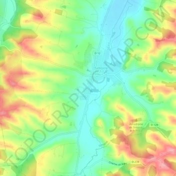
地点:Enchiroulet, Simorre, Auch, Gers, Occitanie, France métropolitaine, 32420, France (43.42655 0.71172 43.46655 0.75172)
平均海拔:241 米
最低海拔:190 米
最高海拔:309 米