
Ama Dablam地形图
点击地图以显示海拔。
Ama Dablam
Ama Dablam was first climbed on 13 March 1961 by Mike Gill (NZ), Barry Bishop (US), Mike Ward (UK) and Wally Romanes (NZ) via the Southwest Ridge. They were well-acclimatised to altitude, having wintered over at 5,800 metres (19,029 ft) near the base of the peak as part of the 1960–61 Silver Hut expedition, led by Sir Edmund Hillary.
关于这张地图
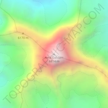
名称:Ama Dablam地形图、海拔、地势。
平均海拔:5,625 米
最低海拔:4,878 米
最高海拔:6,777 米
其他地形图
点击地图以查看其地形、其海拔和其地势。