
Mount Baldhead地形图
点击地图以显示海拔。
Mount Baldhead
Mount Baldhead, also known as Mt. Baldy and Radar Hill, is a 250-foot (76-meter) sand dune located on a narrow strip of land between Lake Michigan and Kalamazoo River, directly across the river from downtown Saugatuck. It has an elevation of 807 feet (246 meters) and is about 70 miles (110 kilometers) north of the Indiana border on the west shore of Michigan in Allegan County.
关于这张地图
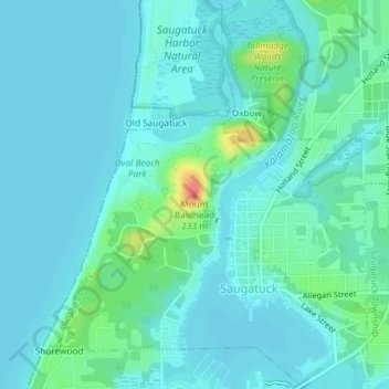
名称:Mount Baldhead地形图、海拔、地势。
平均海拔:184 米
最低海拔:174 米
最高海拔:232 米