
Stirling Range National Park地形图
点击地图以显示海拔。
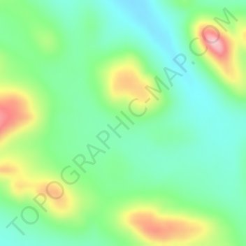
关于这张地图
名称:Stirling Range National Park地形图、海拔、地势。
地点:Stirling Range National Park, Western Australia, Australia (-34.37472 117.83360 -34.35472 117.85360)
平均海拔:341 米
最低海拔:276 米
最高海拔:472 米
其他地形图
点击地图以查看其地形、其海拔和其地势。
Kalbarri
Kalbarri is a coastal town in the Mid West region located 592 km (368 mi) north of Perth, Western Australia. The town is located at the mouth of the Murchison River, which has an elevation of 6 metres (20 ft). It is connected by public transport to Perth via Transwa coach services N1 and N2.
平均海拔:57 米
Rockingham
Rockingham is topographically flat, has sandy soils and coastal vegetation. It has a northern aspect to Cockburn Sound, from Rockingham Beach and Palm Beach.
平均海拔:4 米
Darlington
Very early on, because of its altitude and separation from the Swan Coastal Plain, Darlington became established as a popular picnic area, country drive destination, and a place for holiday homes.
平均海拔:154 米
Henley Brook
Henley Brook is situated on the flood plains of the Swan River, with regularly occurring seasonal floods. Two ephemeral streams from the river - Henley Brook and St. Leonard's Creek - traverse the suburb. Henley Brook is in the north-east near Brockman Street, while St Leonards Creek traverses the centre of…
平均海拔:28 米