
Tinglayan地形图
点击地图以显示海拔。
关于这张地图
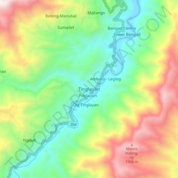
名称:Tinglayan地形图、海拔、地势。
平均海拔:1,032 米
最低海拔:432 米
最高海拔:2,012 米
其他地形图
点击地图以查看其地形、其海拔和其地势。
Chico River
The Chico River, has a total length of 233 kilometres (145 mi), making it the longest tributary of the Cagayan River, itself the largest river in the Philippines. For centuries it has been central to farming, trading, livelihoods, and daily life, whether as a benefit or hindrance. It provided a source of water…
平均海拔:585 米