点击地图以显示海拔。
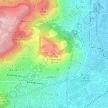
名称:Puy de Chanturgue地形图、海拔、地势。
地点:Puy de Chanturgue, Clermont-Ferrand, Puy-de-Dôme, Auvergne-Rhône-Alpes, France métropolitaine, 63100, France (45.80029 3.09384 45.80039 3.09394)
平均海拔:422 米
最低海拔:333 米
最高海拔:611 米
点击地图以查看其地形、其海拔和其地势。
France > Auvergne-Rhône-Alpes > Puy-de-Dôme > Clermont-Ferrand
平均海拔:437 米
平均海拔:367 米