
Westwood地形图
点击地图以显示海拔。
关于这张地图
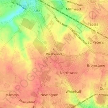
名称:Westwood地形图、海拔、地势。
平均海拔:40 米
最低海拔:4 米
最高海拔:56 米
其他地形图
点击地图以查看其地形、其海拔和其地势。
Stour
United Kingdom > England > Kent > Thanet District
The source, of what is known at that point as the Great Stour, is near the village of Lenham, within a short distance of the River Len, a tributary of the Medway. The source is at a high elevation close to the North Downs escarpment. At first the river flows south east in a narrow valley parallel to the…
平均海拔:7 米