点击地图以显示海拔。
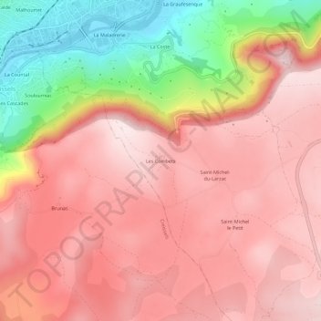
名称:Les Combets地形图、海拔、地势。
地点:Les Combets, Millau, Aveyron, Occitanie, France métropolitaine, 12100, France (44.05684 3.06874 44.09684 3.10874)
平均海拔:643 米
最低海拔:349 米
最高海拔:797 米
点击地图以查看其地形、其海拔和其地势。
France > Occitanie > Aveyron > Millau
平均海拔:508 米
France > Occitanie > Aveyron > Millau > Saint-Lambert
平均海拔:696 米
平均海拔:799 米