
Dhanbad地形图
点击地图以显示海拔。
Dhanbad
Dhanbad has an average elevation of 227 m (745 ft). Its geographical length (extending from north to south) is 15 miles (24 km) and the breadth (stretching across east to West) is 10 miles (16 km). It shares its boundaries with West Bengal in the eastern and southern part, Giridih and Dumka in the North and Bokaro District in the west. Dhanbad comes under the Chota Nagpur Plateau.
关于这张地图
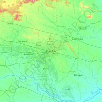
名称:Dhanbad地形图、海拔、地势。
平均海拔:212 米
最低海拔:113 米
最高海拔:633 米