点击地图以显示海拔。
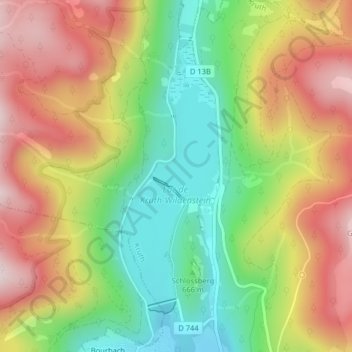
名称:Lac de Kruth地形图、海拔、地势。
地点:Lac de Kruth, Kruth, Thann-Guebwiller, Haut-Rhin, Grand Est, France métropolitaine, 68820, France (47.94636 6.94665 47.96636 6.96665)
平均海拔:733 米
最低海拔:508 米
最高海拔:979 米
点击地图以查看其地形、其海拔和其地势。
France > Grand Est > Haut-Rhin > Kruth
平均海拔:910 米
France > Grand Est > Haut-Rhin > Kruth > Bourbach
平均海拔:727 米